

News
Consultation launched on future of two public toilets
PEMBROKESHIRE COUNTY COUNCIL is launching a consultation on the future of two public toilets at Fishguard and one in Gelliswick, near Milford Haven.
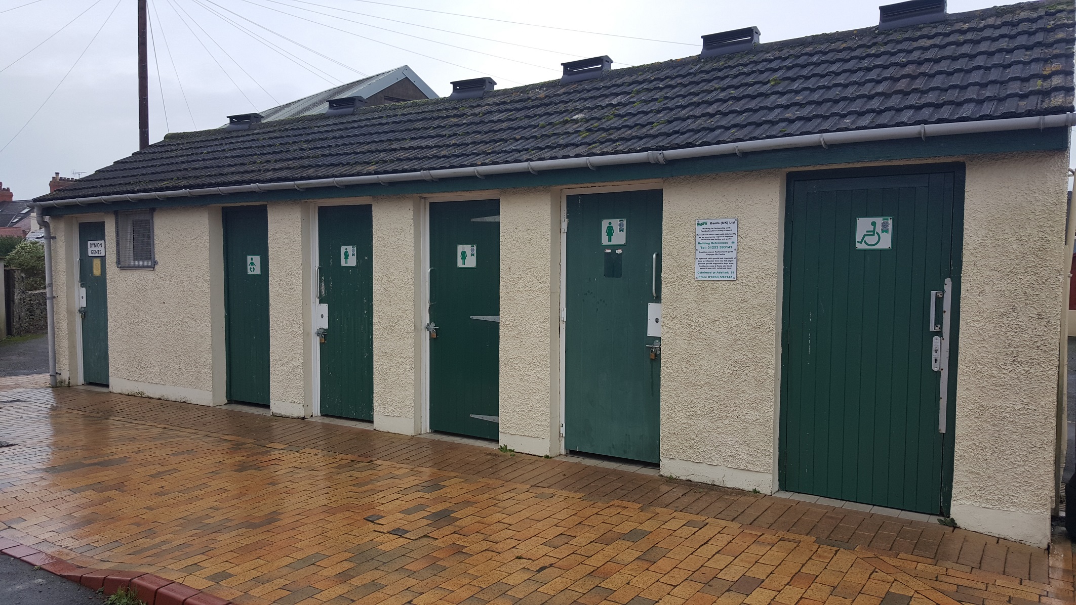
At Fishguard, the Council is proposing to close the facilities in West Street car park, which have been the target of repeated vandalism, and in Parc y Shwt. Both facilities are in need of upgrading.
Instead, a new toilet block would be built in the town centre next to the new bus stop in the Chimney’s Link road development (subject to planning approval).
The other public conveniences at Lower Town Fishguard and Goodwick Parrog would remain.
To find out more about the proposed new toilet block, a drop-in session will be held at Fishguard Market at Fishguard Town Hall on Thursday, April 12, between 10am and 12pm.

If it went ahead, it is proposed that it would be a pay-for-use facility. It would be funded by Danfo (UK) Ltd, the company contracted by the Council to provide public conveniences.
Vandalism has also been a long-running problem at the Council-run public conveniences at Gelliswick, near Milford Haven.
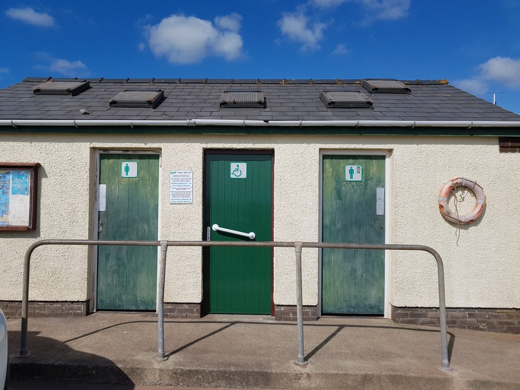
Gelliswick toilets
The block has the highest number of recorded incidents in a 12 month period. Doors have been kicked in, toilet pans smashed and fireworks set off inside. A a result, the toilets have been closed since October 2017.
As part of its consultation, Pembrokeshire County Council would like to hear from community groups interested in taking over responsibility for the toilet block.

Milford Haven Town Council has said it is unable to fund its provision, due to the extensive record of vandalism.
Pembrokeshire County Council proposes that if no viable alternative proposal is received, that the Gelliswick toilets are permanently closed.
To give your views on the Council’s proposals for Fishguard, Gelliswick, or both:

- Complete the online response form (from March 26th) at pembrokeshire.gov.uk/haveyoursay
- OR phone the Contact Centre to request a hard copy document. Once complete, scan in and email to [email protected] or post to: Pembrokeshire County Council, Policy, 2D County Hall, Haverfordwest, SA61 1TP.
The closing date for responses is Friday, May 18.
Responses will be compiled into a report and be used to develop an Integrated Impact Assessment.
These documents will be considered by Cabinet at its meeting in July, when it will make a final decision on the proposals.


Headteacher absent as council confirms support plan and oversight visits
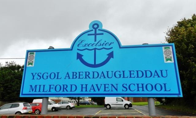
CONCERNS have been raised about leadership and staffing at Milford Haven Comprehensive School following last week’s alleged stabbing of a teacher on site.
The Herald has been contacted by a member of teaching staff who described the school as “rudderless” in the days after the incident and questioned whether enough senior management support was in place.
The teacher, who asked not to be named, said staff morale had been affected and claimed there had been little direct communication from the headteacher, who has been absent due to injury.
They said: “We teachers are all saying the same thing. The school feels rudderless. This is a time when a leader needs to step up and let us know they’re still in charge and concerned.”
Concerns were also raised about administrative capacity, with the business manager role reportedly unfilled.
A spokesperson for Pembrokeshire County Council confirmed the current arrangements.
The council said headteacher Ms C. A. Morris remains in post but is currently absent, with deputy headteacher Mr Daryl John deputising.
It added that the business manager position is a matter for the school.
Additional support has been put in place for staff and pupils, including the Education Psychology team on site, access to counselling services and an increased presence from the School Police Liaison Officer throughout the week.
The authority also said the Director of Education is in daily contact with the deputy head.
In terms of oversight, the council confirmed Steven Richards-Downes, Director of Education, has visited the school 35 times and met staff on two occasions. Cllr Guy Woodham, Cabinet Member for Education and Welsh Language, has made eight visits since taking up the role in May 2019.
Last week’s incident saw a 15-year-old male charged grievous bodily harm with intent and possession of a bladed article.

At an initial hearing it was explained that the teacher, who was named as Vicky Williams, has since been discharged from hospital.
The prosecution explained to the court that the boy attacked Williams with a kitchen knife.
The case has been sent to Swansea Crown Court.

Page disappears hours after offensive post sparks outrage across Pembrokeshire
A FACEBOOK page that presented itself as a local news outlet but repeatedly targeted The Pembrokeshire Herald and its editor has disappeared following a wave of public criticism from residents and charity workers.
The page, operating most recently under the name Clear Line News, published a lengthy post on Sunday (Feb 9) describing Pembrokeshire in highly offensive terms and mocking community groups, volunteers and local reporting.
Within hours, the post triggered widespread condemnation online.
By the end of the day, users reported the page had changed its name to “The Devil’s Feed” before becoming unavailable altogether.
Criticism arose after Marty Jones, PR manager for Sandy Bear Children’s Bereavement Charity, shared a screenshot of the post on his personal Facebook page and questioned its tone.
Dozens of residents replied, describing the language as “vile”, “nasty” and “beyond comprehension”.
Several said they had been blocked by the page after challenging it.
Others expressed particular anger at comments they said were directed towards a bereaved mother connected to a local fundraiser.
One commenter wrote: “How they can speak to a bereaved mother that way is beyond my comprehension.”

Name change and closure
As criticism mounted, users reported the page had been renamed before disappearing completely.
By Monday morning, it could no longer be accessed.
Earlier identity
The page’s history has also drawn scrutiny.
Before operating as Clear Line News, the account previously used the name “Dyfed-Powys Neighbourhood Watch”, presenting itself in a way that some residents believed suggested an official or community safety organisation.

A company using a similar name — GWARCHOD Y GYMDOGAETH DYFED-POWYS NEIGHBOURHOOD WATCH LIMITED — was incorporated on Nov 4, 2024, according to Companies House records.
The filing listed the director as Ajay Owen, recorded as “Lord Ajay Owen”, with a correspondence address in Llanfyrnach.
The company’s stated activities included public relations, communications and public order and safety functions.
Companies House records show the company was dissolved on Feb 18, 2025.
During the period when the page appeared to carry Neighbourhood Watch-style branding, it accumulated more than 1,000 followers, including engagement from public bodies such as Mid and West Wales Fire and Rescue Service.
After several rebrands, the page later emerged as Clear Line News in late 2025, adopting the look of a local news site.
Much of its content, however, focused on opinion pieces and attacks on local institutions and individuals.
Distancing statement
Following Sunday’s controversy, Mr Owen posted a statement saying he previously owned the page but no longer controlled it and had requested its removal.
Shortly afterwards, the account disappeared.
He told The Herald in December that he had sold the page for £10 within days of relaunching it under the new name. The purported new owner could not be contacted and no independent details confirming the transfer were provided.
Community response
While Pembrokeshire residents accept robust debate and scrutiny, many said they rejected what they saw as inflammatory or abusive social media content masquerading as journalism.
One resident wrote: “We should be grateful for where we live and try to make it better, not tear it down.”
Whether the page returns under another name remains unclear.
For now, it appears a site that set out to criticise the community ended up undone by that same community’s response.

A £1,000 grant from Nacro is set to strengthen grassroots support for neurodivergent children, young people and adults across Carmarthenshire.
CANDO (Carmarthen Aberystwyth Neurodiverse Outreach Group) has secured the funding through the Connecting Carmarthenshire Preventative Service, enabling the volunteer-led organisation to expand its practical, person-centred work with local families.
Operating under the message “We see your future whatever the past”, CANDO supports people who often struggle to access the right help, feel heard, or find stability in everyday life. The new funding will increase capacity, provide resources for inclusive sessions, and improve access to early support for those who might otherwise slip through the net.

The group works closely with individuals and families to reduce barriers and build confidence — whether through education guidance, wellbeing support, advocacy, or help navigating local services. Leaders say the grant will allow them to respond more quickly to growing demand and keep sessions welcoming, accessible and consistent.
A CANDO spokesperson said: “This grant is amazing news for our community. Neurodivergent people can face extra pressures — from isolation and anxiety to difficulties being understood in education and services. This support will help us reach more people, provide practical help, and keep showing up for those who need someone on their side.”
Nacro’s wider mission mirrors that approach. The charity works across education, housing, justice, health and wellbeing, providing tailored support to help people build independence and move forward. Alongside frontline services, it also campaigns to remove systemic barriers and give disadvantaged people a stronger voice.
For CANDO, that bigger picture is felt locally. Families often face complicated pathways, long waits and fragmented services, and need clear guidance and community-based help that understands neurodiversity. By intervening early — before challenges escalate — the group believes it can improve mental health, education outcomes and overall wellbeing.
The £1,000 grant will fund additional outreach, materials and practical resources, helping more people feel safer, more confident and better equipped to move forward.
CANDO added: “We’re proud to work alongside Nacro’s vision of a society where everyone has the chance to succeed. This funding will do real good — right here in Carmarthen and beyond — and we’re grateful for the belief it shows in our community.”


News16 hours ago
Man to return to court over alleged harbour collision
Three charges relate to navigation of vessel in Milford Haven A NEWPORT man is due to return to court later...


Business2 days ago
Computer Solutions Wales under fire from customers
Claims of unreturned devices, unpaid refunds and small claims court cases as company blames landlord dispute CUSTOMERS across west Wales...


News2 days ago
Starmer under fire as aides quit and Scottish Labour leader calls on him to resign
Two senior Downing Street exits in 24 hours as Anas Sarwar breaks ranks, but ministers insist the Prime Minister is...


News2 days ago
Fresh concerns over £60m A40 scheme after resurfacing works just months after opening
QUESTIONS are being asked about the condition of the newly-opened A40 Llanddewi Velfrey to Redstone Cross carriageway after sections of...


Charity2 days ago
RSPCA looks back at the Sea Empress oil tanker disaster 30 years on
Charity reflects on one of the biggest environmental disasters to hit UK IN just a few days time it will...


Crime3 days ago
Pembroke Dock man admits threatening to hack woman’s head off with sword
Court imposes strict bail conditions and bans contact with named individuals ahead of sentencing A PEMBROKE DOCK man has admitted...


Crime4 days ago
Teenager remanded after teacher injured in knife incident at Milford Haven school
Fifteen-year-old charged with Section 18 grievous bodily harm and possession of a bladed article appears before Swansea magistrates A FIFTEEN-YEAR-OLD...


Crime4 days ago
Police confirm teacher was stabbed at school as teenager appears in court
15-year-old charged with Section 18 GBH with intent and possession of a bladed article on education premises POLICE have confirmed...


Crime4 days ago
Man arrested for murder following death of pensioner in Pembroke Dock
Officers called to Hawkstone Road property as investigation continues and residents urged to come forward DYFED-POWYS POLICE officers have launched...


Crime5 days ago
Teacher discharged as Milford School to reopen Monday after serious assault
Deputy head praises ‘calm and professional’ staff and pupils during lockdown A TEACHER injured in a serious incident at Milford...
-

 Health6 days ago
Health board targets rise in steroid and gym drug use across west Wales
-

 Crime6 days ago
Sex offender jailed after living off grid in Pembrokeshire and refusing to register
-

 Crime6 days ago
Teacher injured and teenager arrested for attempted murder at Milford Haven School
-
Business2 days ago
Computer Solutions Wales under fire from customers
-

 Business5 days ago
Six-figure negligence victory leaves retired builder trapped in divorce limbo
-

 Crime7 days ago
Johnston man remanded in custody over knife and assault charges
-

 News6 days ago
Reform appoints Dan Thomas to lead party in Wales
-

 Crime7 days ago
Provisional licence holder admits drink-driving through town centre