

News
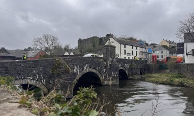
Cleddau Bridge Hotel housing scheme moves ahead
35 affordable homes to replace fire-damaged site in Pembroke Dock
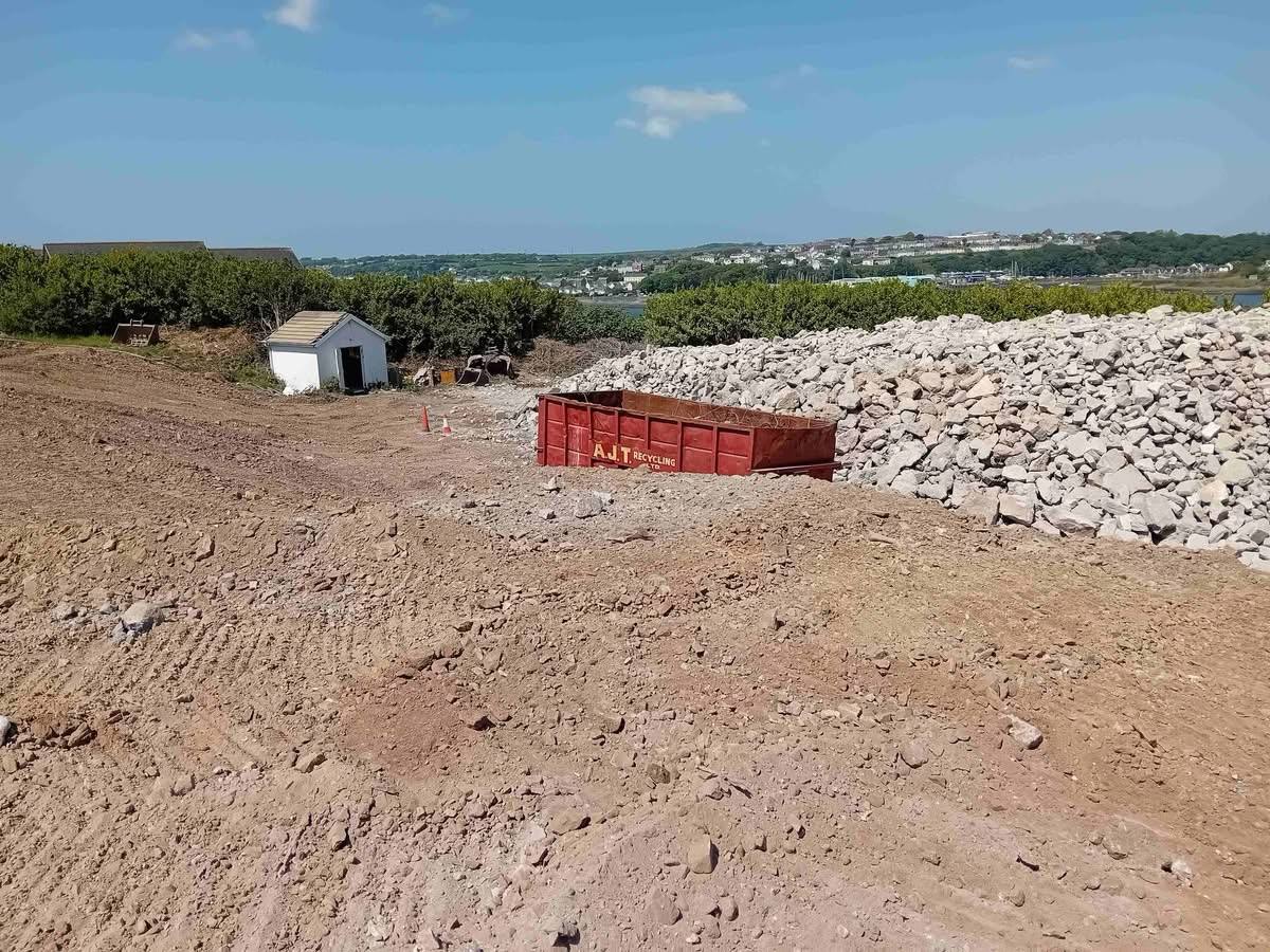
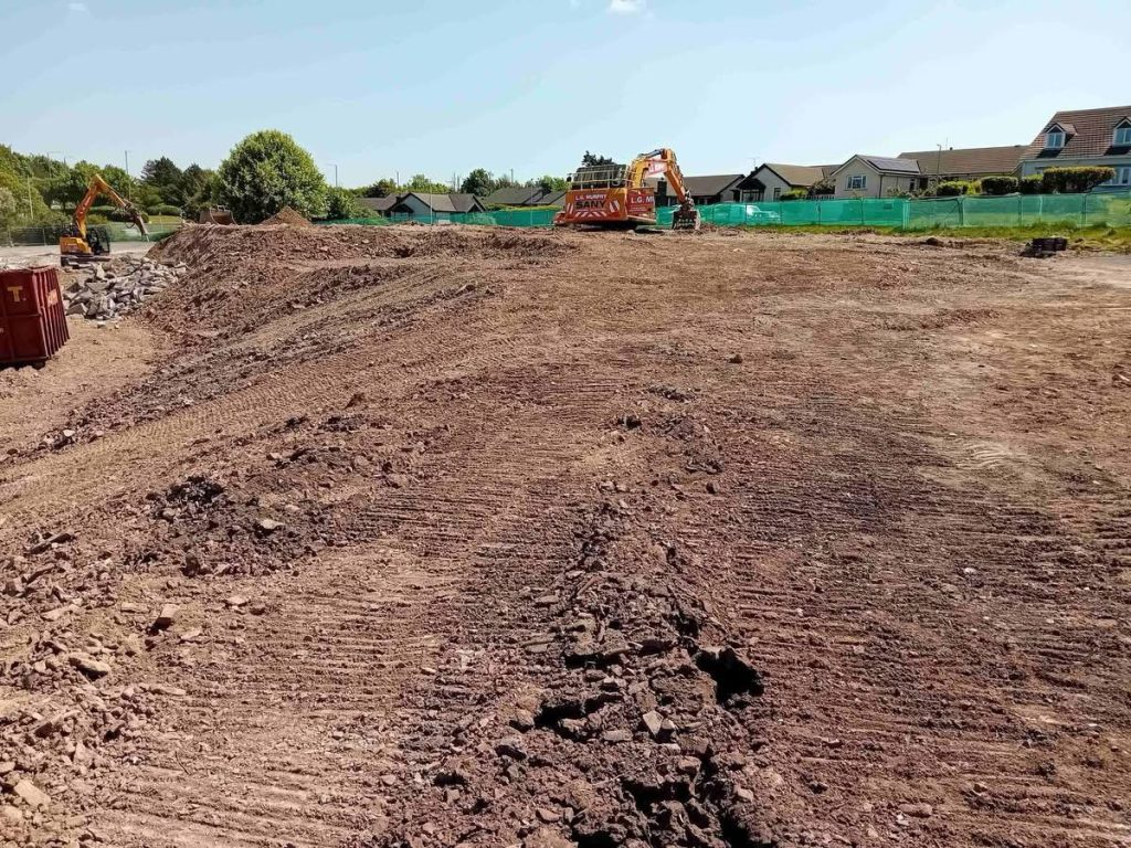
THE REDEVELOPMENT of the former Cleddau Bridge Hotel site in Pembroke Dock has taken a significant step forward, as Castell Group and Pembrokeshire County Council confirm the completion of the site sale.
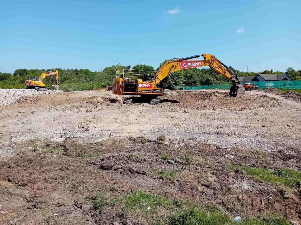
The site, which has stood derelict since a devastating fire in 2019, was acquired unconditionally by Castell Group in April 2024. Since then, planning permission and Sustainable Drainage (SAB) approval have been secured, clearing the way for construction to begin.
Using a social housing grant from the Welsh Government, the new scheme will deliver 35 affordable homes—providing a mix of social, supported, and intermediate rental properties. All homes will be owned and managed by Pembrokeshire County Council.
The development marks a key milestone in bringing a long-neglected brownfield site back into use, with anticipated economic and social benefits for the wider area.
Dorian Payne, Managing Director of Castell Group, said: “We are delighted to reach this critical stage in the redevelopment of the Cleddau Bridge Hotel site. We are excited to move forward with construction in collaboration with Pembrokeshire County Council.”

Cllr Michelle Bateman, Cabinet Member for Housing, welcomed the news: “This site has been derelict since the fire in 2019 so it’s fantastic news that it will now be developed into high-quality affordable housing. We are committed to increasing the supply of affordable housing and this development, in one of our largest towns, will play a part in meeting the demand for housing in Pembrokeshire.”
Local member Cllr Joshua Beynon added: “I am really pleased to see the Council developing this piece of land that has been left as an eyesore since it caught fire some years ago. Housing is what we need, and I’m really pleased to see it happening here.”
Work on site is expected to begin shortly.
Anyone interested in applying for one of the new homes is advised to ensure their housing application is up to date. For further information, contact the Customer Liaison Team at [email protected] or call 01437 764551.

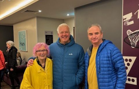
A WELL-KNOWN Welsh weather presenter was spotted in Pembrokeshire as he filmed scenes for a new series celebrating the county’s coastline.
Derek Brockway, who has been a familiar face on BBC Wales since 1995, was in St Davids recently working on another instalment of his popular walking series along the Pembrokeshire Coast.
Local resident Thomas Tudor said it was “lovely” to meet the broadcaster during filming, posing for a photograph alongside his mother, Beryl Tudor, and sister, Bethan Thomas Price.
Brockway, who is based at BBC Cymru Wales in Cardiff, is widely known not only for his weather forecasts across television, radio and online, but also for his programmes showcasing Wales’ landscapes and coastal paths.
The latest filming in St Davids is expected to form part of an upcoming series highlighting the natural beauty and walking routes of Pembrokeshire, an area long regarded as one of the jewels in Wales’ tourism crown.

A MAJOR new childcare support scheme for Armed Forces families will be rolled out across Wales from September 2026, the UK Government has announced.
The initiative is expected to save eligible families up to £6,000 per child each year, providing a significant boost to household finances amid ongoing cost-of-living pressures.
The scheme will be delivered through the Ministry of Defence’s existing Early Years childcare reimbursement system and will bring Wales in line with the level of support already available to forces families in England.

Ministers say the move is part of a wider effort to improve recruitment and retention in the Armed Forces, with childcare costs identified as a key pressure affecting morale.
The new support will cover children from nine months old until they reach three years of age in Wales and Scotland, and up to four years old in Northern Ireland.

Defence Secretary John Healey MP announced the scheme during a visit to Dreghorn Barracks in Edinburgh.
He said: “Our Armed Forces families are at the heart of our nation’s security. As the demands on defence increase, it is right that we step up our support for those who serve.
“This offer will ensure more military families get the childcare support they need, wherever they are posted.”
Secretary of State for Wales Jo Stevens added: “Service families in Wales make huge sacrifices and deserve the best possible support.

“They contribute not only to our national security but also to the Welsh economy. This scheme delivers meaningful help with the cost of childcare.”
The scheme will reimburse the difference in early years childcare costs for eligible working families. To qualify, both parents must be in employment and meet the income thresholds required for a Tax-Free Childcare account.
Hundreds of families across Wales are expected to benefit.

The announcement forms part of a broader package of support introduced since July 2024, including improved military housing, the largest Armed Forces pay rise in two decades, and plans to strengthen the Armed Forces Covenant in law.
Further details will be provided in the coming months, with families encouraged to begin considering childcare arrangements ahead of the scheme’s launch.
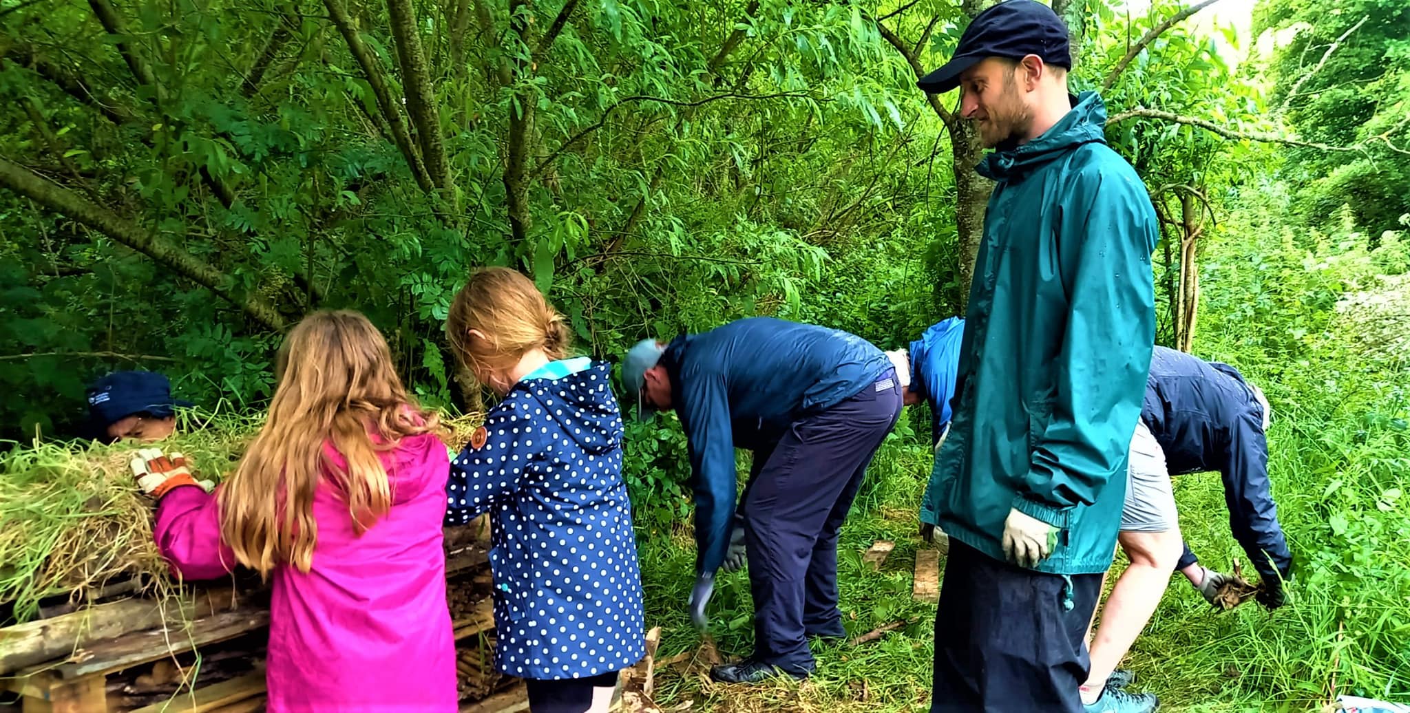
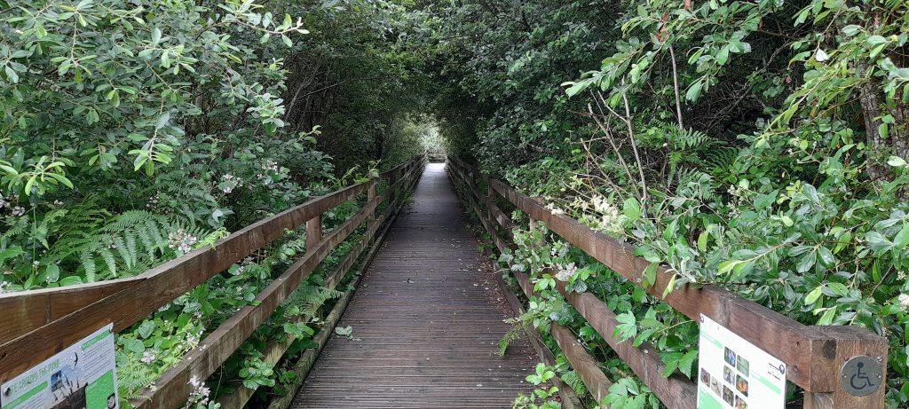
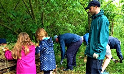
A SMALL stretch of woodland and former opencast coal mine has been transformed into a nationally recognised biodiversity site, in a major first for Wales.
The Slash Pond Community Nature Reserve has been awarded ‘Naturfa’ status, becoming the first community-managed site in Wales to receive the designation.
The recognition, confirmed by Deputy First Minister Huw Irranca-Davies, classifies the reserve as an “Other Effective Area-based Conservation Measure” (OECM). This means the volunteer-led work of the Support the Boardwalk group will now contribute directly to Wales’ 30×30 target – the global commitment to protect 30% of land, freshwater and sea for nature by 2030.
In a further boost, the site has also been included in the National Forest for Wales, recognising its role in strengthening a connected network of woodlands and habitats across the country.
Once a simple local walkway, the Slash Pond has developed into a thriving wildlife haven. The reserve now supports a wide range of species, including critically endangered European eels, otters, ten species of bat, and more than fifty species of birds, alongside diverse aquatic plants and insects.

Huw Irranca-Davies said: “These special places are a testament to the care and dedication of people working on the ground – securing a legacy for future generations. Nature can only thrive where habitats are resilient, protected and effectively managed.”
The new status is expected to unlock future funding opportunities, supporting long-term plans for maintaining the boardwalk, monitoring biodiversity and water quality, installing new signage, and expanding environmental education work with Broad Haven Primary School and the wider Havens community.
Andy Drumm, a volunteer with Support the Boardwalk, said: “We’ve always known how special the Slash Pond is, but this recognition puts it firmly on the map as a national asset. It’s a tribute to years of hard work and shows that local communities can lead the way in tackling the nature crisis.”
To mark the achievement, a Spring Family Fun Day will take place on Friday (May 9) from 1:00pm to 4:00pm at the Slash Pond car park.

The event will feature guided nature walks, pond dipping, a wildlife treasure trail, live music, and family activities including crafts and face painting. The official unveiling of the Naturfa certificate and new reserve branding will also take place, alongside the launch of a new book, From Culm to Calm: A History of the Slash Pond by local author David Meanwell.
Karen Riggs, a long-time volunteer, said: “This achievement belongs to everyone in Broad Haven who has supported the site over the years. We’re not just celebrating a new title – we’re celebrating what our community has built together.”
The day will also see the installation of new benches at the observation decks and the launch of a floating island habitat to support wildfowl and other bird species. Visitors will also be invited to share feedback on plans for an improved picnic area designed to withstand local flooding.

Naturfa is a Welsh Government initiative recognising areas outside traditional protected sites, such as SSSIs, that are managed in ways which deliver long-term benefits for biodiversity.
The Slash Pond Community Nature Reserve is managed by the Support the Boardwalk group in partnership with The Havens Community Council, and is maintained entirely by volunteers.
Further information and updates are available via the Support the Boardwalk Facebook page.

Community9 hours ago
Broad Haven volunteers secure ‘national asset’ status for nature reserve
A SMALL stretch of woodland and former opencast coal mine has been transformed into a nationally recognised biodiversity site, in...


Entertainment1 day ago
Tenby steams up in spectacular style as crowds flock to festival
Colourful parade, towering creations and Victorian flair bring town centre to life TENBY was transformed into a vibrant Victorian fantasy...


Crime3 days ago
Publican jailed for six years for supplying cocaine and cannabis
Milford Haven man sentenced at Swansea Crown Court following drug dealing operation A MILFORD HAVEN publican has been jailed for...


Local Government3 days ago
Poverty summit highlights support efforts across Pembrokeshire
A SUMMIT bringing together key organisations from across Pembrokeshire has highlighted both the scale of local poverty and the work...


Education3 days ago
Milford Haven school plans unveiled but funding not yet secured
PLANS for a new £100 million school in Milford Haven have been unveiled, but the project has not yet secured...


News4 days ago
Council unveils plans for new state-of-the-art secondary school in Milford Haven
PEMBROKESHIRE COUNTY COUNCIL has revealed plans for a new state-of-the-art school in Milford Haven, promising modern, inspiring learning spaces for...


Health4 days ago
NHS waiting list falls — but cancer delays and diagnostic backlog worsen
Record progress claimed by Welsh Government as critics warn key targets are still being missed THE NHS in Wales has...


Crime5 days ago
Rapist jailed after ‘abhorrent’ attacks on woman and children
Haverfordwest man told police “women won’t have sex without force” A HAVERFORDWEST man who raped a woman and a young...


News5 days ago
Reform secures first Pembrokeshire councillor in Hakin by-election win
Late Reform candidate takes seat as independent surge and Labour withdrawal shape contest REFORM UK candidate Scott Thorley has won...


News5 days ago
Scott Thorley elected as Pembrokeshire’s first Reform councillor
REFORM UK candidate Scott Thorley has won the Hakin by-election after securing 179 votes. The full result is as follows:...
-
 News6 days ago
Emergency services flood Haverfordwest after reports of person in river
-

 Crime4 days ago
Mother given community order after admitting child cruelty offence
-
Health4 days ago
NHS waiting list falls — but cancer delays and diagnostic backlog worsen
-

 News5 days ago
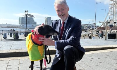
Senedd vote to ban greyhound racing hailed as ‘landmark moment’ by charities
-
 News5 days ago
Senedd votes to ban Greyhound racing in Wales to protect animal welfare
-
News5 days ago
Reform secures first Pembrokeshire councillor in Hakin by-election win
-

 Crime4 days ago
Woman stole from pharmacy despite ban, court hears
-

 News7 days ago
£3.8m to help Welsh families struggling with soaring heating oil costs