

News
Where’s Wally: Has Tenby Walrus disappeared for a quiet life?
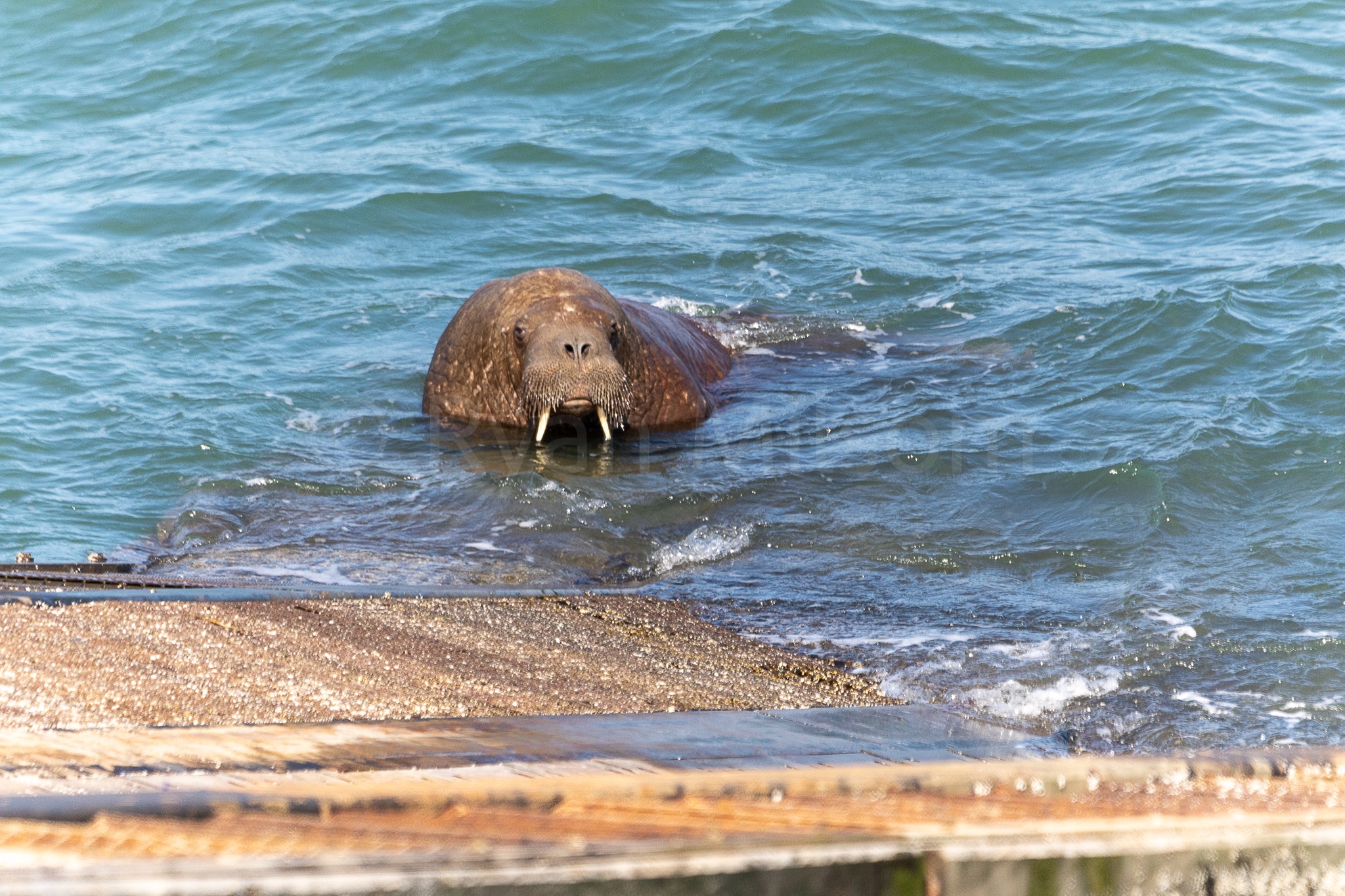
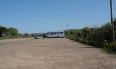
TENBY’S most famous visitor, Wally The Walrus, has disappeared after being repeatedly disturbed by members of the public getting too close to him on the slipway to Tenby’s Lifeboat Station.
Last spotted at around 7am on Bank Holiday Monday, the Arctic Walrus was the subject of intense interest for many people, local and visitor alike.
Sadly, neither locals nor visitors heeded advice given by experts and continually got too close to the Walrus who, it seems, got ‘spooked’ and has departed our shores for good.
A statement issued at the weekend by British Divers Marine Life Rescue, Tenby harbour master Chris Salisbury, the RSPCA, Tenby lifeboat coxswain Phil John, CSIP Marine Environmental Rescue, Welsh Marine Life Rescue, and Natural Resources Wales, warned us all that it was in Wally’s “best interests to be left alone as much as possible” and implored people to “avoid the temptation to get near to him and disturb him”.
The joint statement they released also mentioned that they were “concerned” to hear that members of the public had “tried to get close to him by using personal watercraft or paddle and surfboards”.
Unable to help themselves, people were repeatedly seen ignoring advice and getting far too close to him, something that Terry Leadbetter, co-ordinator at Welsh Marine Life Rescue believes Wally would’ve been aware of.

“There’s been all sorts of boats, watercraft, jet-skis, paddleboards, canoes, dinghies, yachts, all sailing across the areas where he normally feeds.” Said Terry “I believe the harbour master put signs up saying to avoid that particular area.
“People have been travelling across the border from places like Leeds and Essex just to see him.
“He was last seen at 7am on Monday morning at the lifeboat station and has not been seen since. There have been boats trying to find him but where he’s gone, we don’t know.
“The poor thing has had eyes on him the whole time and he’s had a lot of disturbance while he’s been there.

“His only haul out was the lifeboat station. They go out and feed and then come in and try to sleep but if they can’t get sleep then that to me is a disturbance.
“Now he’s gone and whether it’s because he’s exhausted his food supply, I don’t know. He’s only about half his weight at about 500kg so he’s probably going to grow to around 1,200kg.”
Whatever you believe, all we know is that Wally hasn’t been seen in 3 days now and even boats that have gone out looking for him haven’t found a sign of the wandering Walrus who was also seen off the coast of Kerry in the Republic of Ireland before taking up residency at Tenby.


Defendant admitted using Xbox without informing police as required under court order
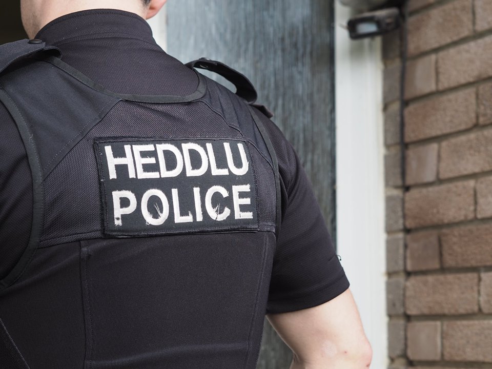
ANTHONY COOMBES, aged 26, of Sand Banks, Broad Haven, appeared before Llanelli Magistrates’ Court on Thursday (Mar 20) charged with breaching a sexual harm prevention order.
The court heard that between February 26 and March 19, 2026, at Haverfordwest, Coombes repeatedly breached the order by using an Xbox device without informing police within three days, as required.
The offences relate to a sexual harm prevention order imposed at Swansea Crown Court on October 20, 2021.
Coombes indicated guilty pleas to the offences at the first hearing.
Magistrates committed the case to Swansea Crown Court for sentence.

He was remanded in custody ahead of the next hearing, which is due to take place at 9:00am on Friday, April 3, at Swansea Crown Court.
The court refused bail on the grounds that he was likely to offend, citing the nature and seriousness of the offences and his previous record and character.
A pre-sentence report was ordered.
Police say death not suspicious as 46-year-old arrested over alleged Class A drug supply
A MAN has died following a medical emergency at a property in Haverfordwest, police have confirmed.
Emergency services were called at 3:18pm on Wednesday (March 18) after a report of a medical incident.
A man was pronounced dead at the scene.
Dyfed-Powys Police said the man’s next of kin have been informed and are being supported by officers.
The death is not being treated as suspicious at this time.

However, police confirmed that a man, aged 46, was arrested on suspicion of being concerned in the supply of Class A drugs.
He has since been released under investigation while enquiries continue.
No further details about the deceased have been formally released.

FOUR people from Mynyddygarreg, Kidwelly, have been ordered to pay more than £129,000 following a successful prosecution for illegal dog breeding.
At Swansea Crown Court on Tuesday (Mar 10), before His Honour Judge Thomas KC, Stacey May June Edwards, Peter John Edwards, Sian Eleri Thomas and David Malcolm James Thomas, all of Sea Breeze, Mynyddygarreg, pleaded guilty to offences under the Breeding of Dogs (Wales) Regulations 2014.
The court imposed confiscation orders totalling £129,873.41 under the Proceeds of Crime Act across the four defendants. They were also ordered to pay £8,000 in costs, while each defendant received a £2,000 fine.
The investigation began in April 2021 after Carmarthenshire County Council’s Animal Health team received an enquiry from Peter Edwards about obtaining a dog breeding licence. Although licensing guidance was provided and a partial application was submitted in February 2022, this was later withdrawn.
In March 2024, the council received a complaint that puppies were being advertised for sale without the required licence. Officers subsequently contacted online advertising platforms and issued data requests to assess the scale of activity.
Analysis of records from Pets4Homes, Freeads and Gumtree revealed multiple litters being advertised by members of the same household.
Correspondence under the Police and Criminal Evidence Act confirmed that up to 25 dogs were kept at the property, including between 16 and 19 breeding females.
While some defendants claimed joint ownership of the dogs, others attempted to minimise their involvement.
The Herald understands that numerous puppy advertisements were posted between July 2020 and April 2025, demonstrating a sustained pattern of unlicensed breeding.
Carmarthenshire County Council’s Cabinet Member for Climate Change, Decarbonisation and Sustainability, Cllr Aled Vaughan Owen, said: “This case demonstrates the council’s firm stance against unlicensed and illegal dog breeding.
“These regulations are in place to protect animal welfare and ensure that breeding activities are subject to proper oversight. The scale of activity uncovered at this property was entirely unacceptable, and we welcome the court’s decision to issue significant confiscation orders under POCA.”
He added: “We urge anyone with concerns about illegal dog breeding to report it. Our Animal Health officers will continue to investigate thoroughly and take action against those who disregard the law.”

Residents are reminded that anyone breeding and selling dogs must comply with licensing regulations designed to protect both animal welfare and consumers.

Crime14 hours ago
Publican jailed for six years for supplying cocaine and cannabis
Milford Haven man sentenced at Swansea Crown Court following drug dealing operation A MILFORD HAVEN publican has been jailed for...


Local Government16 hours ago
Poverty summit highlights support efforts across Pembrokeshire
A SUMMIT bringing together key organisations from across Pembrokeshire has highlighted both the scale of local poverty and the work...

Education2 days ago
Milford Haven school plans unveiled but funding not yet secured
PLANS for a new £100 million school in Milford Haven have been unveiled, but the project has not yet secured...


News2 days ago
Council unveils plans for new state-of-the-art secondary school in Milford Haven
PEMBROKESHIRE COUNTY COUNCIL has revealed plans for a new state-of-the-art school in Milford Haven, promising modern, inspiring learning spaces for...


Health2 days ago
NHS waiting list falls — but cancer delays and diagnostic backlog worsen
Record progress claimed by Welsh Government as critics warn key targets are still being missed THE NHS in Wales has...


Crime3 days ago
Rapist jailed after ‘abhorrent’ attacks on woman and children
Haverfordwest man told police “women won’t have sex without force” A HAVERFORDWEST man who raped a woman and a young...


News3 days ago
Reform secures first Pembrokeshire councillor in Hakin by-election win
Late Reform candidate takes seat as independent surge and Labour withdrawal shape contest REFORM UK candidate Scott Thorley has won...


News3 days ago
Scott Thorley elected as Pembrokeshire’s first Reform councillor
REFORM UK candidate Scott Thorley has won the Hakin by-election after securing 179 votes. The full result is as follows:...

News4 days ago
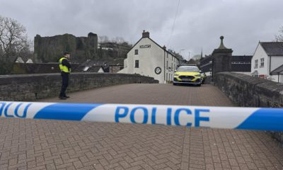
Police confirm man has died after being recovered from River Cleddau
Major emergency response in town centre after concerns raised for man in water A MAN has died after being recovered...


Community4 days ago
Davies and Kurtz urge groups to seek employability funding
Community organisations in Pembrokeshire encouraged to apply for new grants supporting skills and job access LOCAL Senedd Members Samuel Kurtz...
-

 News7 days ago
Rayner and Lammy visit Wales to discuss justice and community safety
-
 News6 days ago
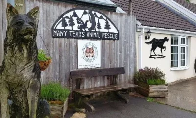
Fishguard linked to allegations in Many Tears Animal Rescue investigation
-
 News4 days ago
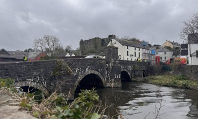
Emergency services flood Haverfordwest after reports of person in river
-
 Local Government7 days ago
Investigation confirmed after inspectors visit Many Tears Animal Rescue
-

 Crime3 days ago
Mother given community order after admitting child cruelty offence
-
 Business7 days ago
Legal action backed in case over development at Dinas Cross
-

 Business7 days ago
Oil firm praised for putting customers first during price surge
-
 Community7 days ago
Town hall takeover plan questioned as cost figures conflict